PVcase Ground Mount
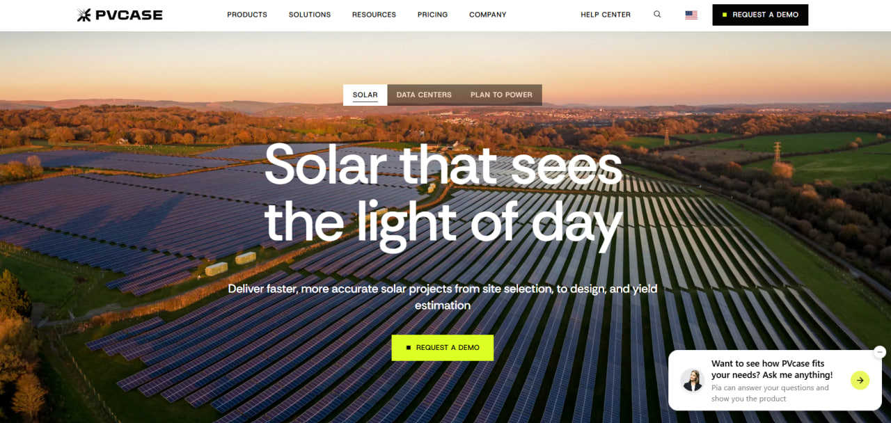
Pros
- Can reduce overall design time by approximately 90% compared with traditional manual CAD workflows.
- Provides millimeter-level terrain tracking that helps minimize expensive and destructive land grading.
- Keeps site selection, layout design, and yield estimation within one connected ecosystem.
- Operates through familiar AutoCAD commands, making it easier to onboard experienced CAD designers.
- Exports bills of materials, single-line diagrams, and structural post schedules directly from active project files.
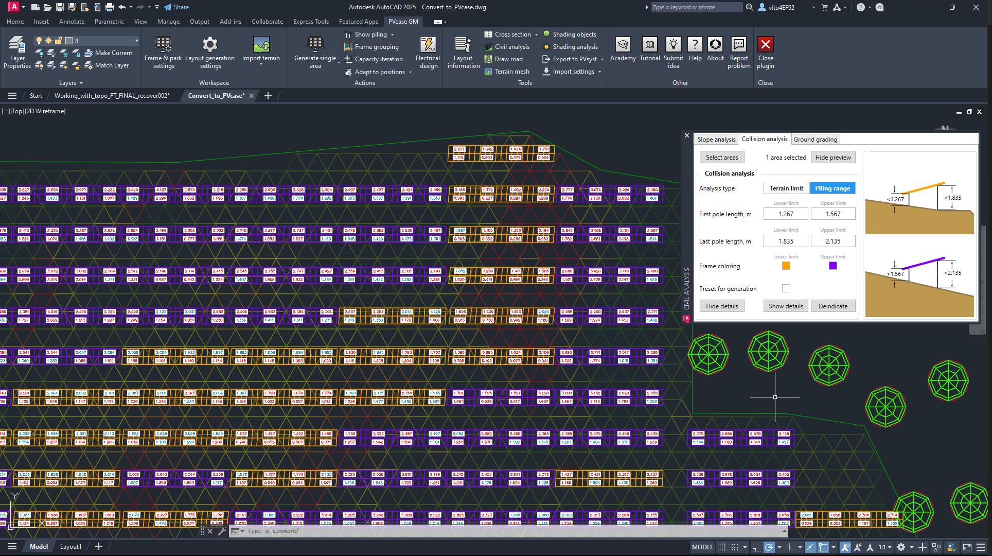
- Identifies structural collisions and shading issues before construction begins.
Cons
- Public pricing is unavailable, so potential customers must complete a formal sales process to receive licensing costs.
- Requires an active Autodesk AutoCAD license and practical knowledge of the CAD environment.
- Advanced terrain-following variables and custom string settings may involve a learning curve.
- Requires high-density LiDAR or accurate topographical data to provide the full benefits of its terrain adjustment features.
Designing massive solar farms usually involves a mountain of manual work, from figuring out individual post heights on rolling hills to mapping out miles of electrical wiring. Traditionally, engineers had to juggle disconnected 2D files and spreadsheets, which slowed things down, risked data errors, and often led to headaches on-site if the paperwork didn’t match the actual terrain.
PVcase Ground Mount fixes these bottlenecks by bringing specialized engineering tools directly into AutoCAD. The software lets developers and EPC teams import real topographic data and generate highly accurate layout options on tricky landscapes in a fraction of the time. By taking care of the tedious drafting tasks, it lets teams scale their design pipelines and confidently move large projects from initial planning to construction-ready blueprints.
What Is PVcase Ground Mount?
PVcase Ground Mount is an advanced solar engineering tool built specifically for utility-scale and large ground-mounted solar installations. Operating as a direct plugin for Autodesk AutoCAD, it adds specialized solar design logic straight into a standard CAD workspace so engineers can build complex layouts without losing any native drafting tools.
The software is built for EPC engineers, utility-scale developers, civil designers, and consultants managing large projects, typically over 1 MW. It replaces fragmented workflows by letting teams handle terrain adaptation, automated racking and post placement, and detailed electrical wiring inside a single file.
PVcase is a widely used platform in the renewable energy industry, helping design over 4 TW of capacity each year for more than 1,800 clients worldwide.
Features
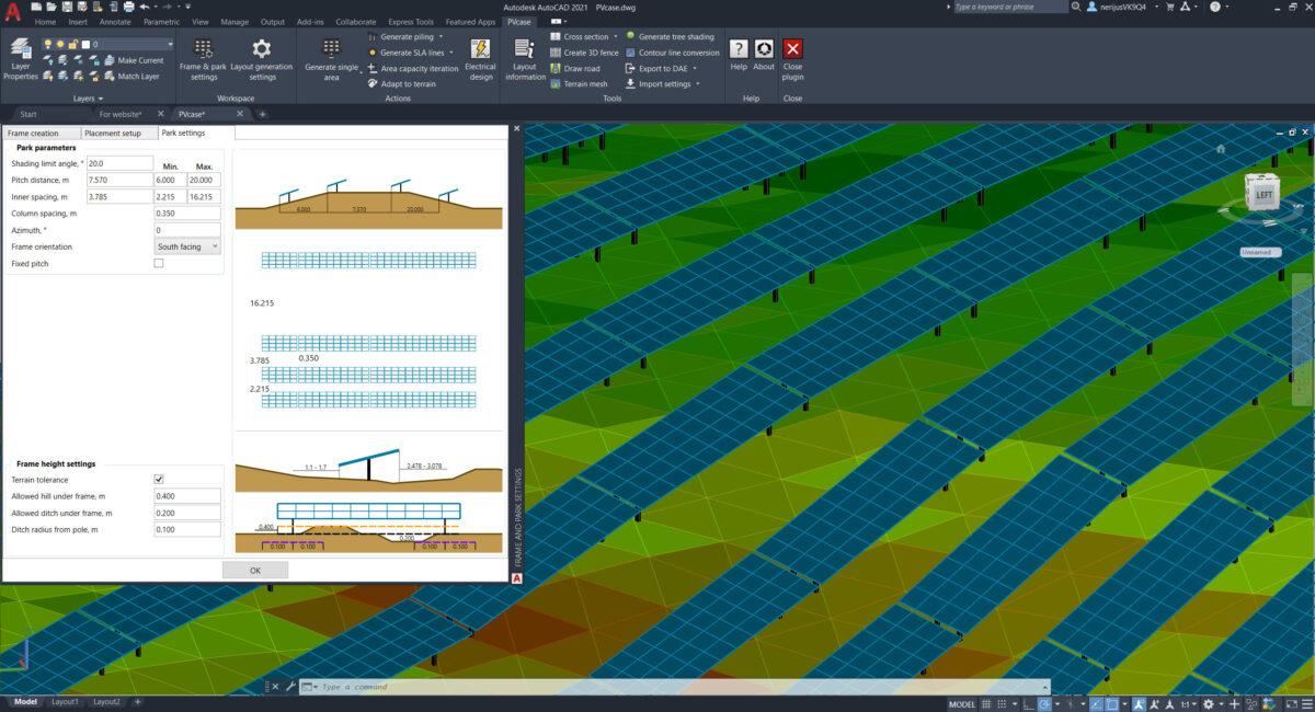
- 3D Terrain Modeling: Imports high-resolution topographical data such as LiDAR point clouds and drone scans to build an accurate 3D surface model, ensuring solar layouts adapt to the natural landscape.
- Automated Pile Scheduling: Automatically calculates the exact height and placement of thousands of structural support posts across uneven ground, reducing spreadsheet work and extensive grading.
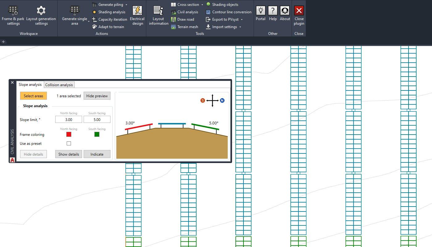
- Terrain-Responsive Layout Automation: Generates layouts that follow the natural slopes of the land, handling inclines of up to 37% and post-to-post grade changes of up to 26%.
- Tracker and Fixed-Tilt Simulation: Supports configurable layouts for fixed-tilt systems and single-axis trackers. The platform models tracker movement on uneven ground to ensure moving components safely clear the terrain at every angle.
- Comprehensive Shading Analysis: Evaluates local topography, nearby obstructions, and neighboring rows to calculate shading losses and display them directly on the layout.
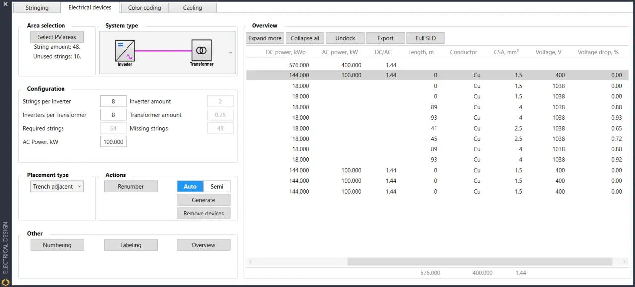
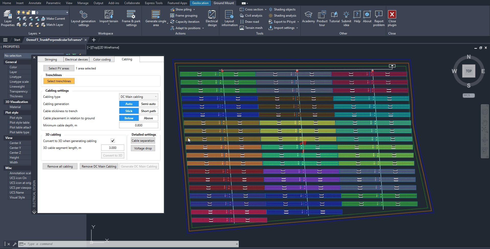
- Automated Electrical Design and Cabling: Automates string mapping and device placement based on custom specifications. It routes DC and AC collection lines across the site and generates detailed single-line diagrams.
- QuickYield Estimation: Runs early-stage yield assessments directly inside the design interface, allowing teams to compare layouts and review baseline production estimates without using external software.
Screenshots
PVcase Ground Mount Pricing
PVcase Ground Mount does not publish official pricing on its website. Enterprise subscriptions are customized according to team size, project scale, location, and required modules.
Interested organizations must contact the PVcase sales team or request a live demonstration to receive a tailored quote.
Industry listings indicate that a commercial license may cost around $12,999 per year. However, the actual price may vary depending on location, subscription terms, number of users, and selected add-ons.
Integrations
- Engineering Tool Integrations: Runs natively inside Autodesk AutoCAD and supports standard DWG, DXF, and point-data files.
- Performance Simulation Tools: Provides a one-click workflow for transferring 3D terrain and shading data into PVsyst for final yield validation and bankable reporting.
- GIS Platforms: Supports the import of digital elevation models, LiDAR data, topographic layers, and other standard geospatial information.
- PVcase Product Suite: Connects with other PVcase products, allowing teams to transfer data between PVcase Prospect, Ground Mount, and the PVcase Yield engine.
How to Set Up PVcase Ground Mount
- Request a live product demonstration or enterprise trial through the official PVcase website.
- Coordinate with a company representative to establish a subscription agreement and obtain user license keys.
- Install a compatible and up-to-date version of Autodesk AutoCAD on the local workstation.
- Download the PVcase Ground Mount installer from the user portal and run the setup to add the tools to AutoCAD.
- Configure measurement units, framing standards, structural parameters, and custom equipment portfolios.
- Import land surveys, LiDAR coordinates, digital elevation models, or DWG site plans to define the project boundaries and begin designing.
How to Use PVcase Ground Mount
A typical design process in PVcase Ground Mount starts by importing topographic point clouds or digital elevation model data to create an accurate 3D mesh of the project site. The user then outlines the property boundaries, defines environmental exclusion zones, and selects structural specifications such as tracker types, pitch, and row spacing.
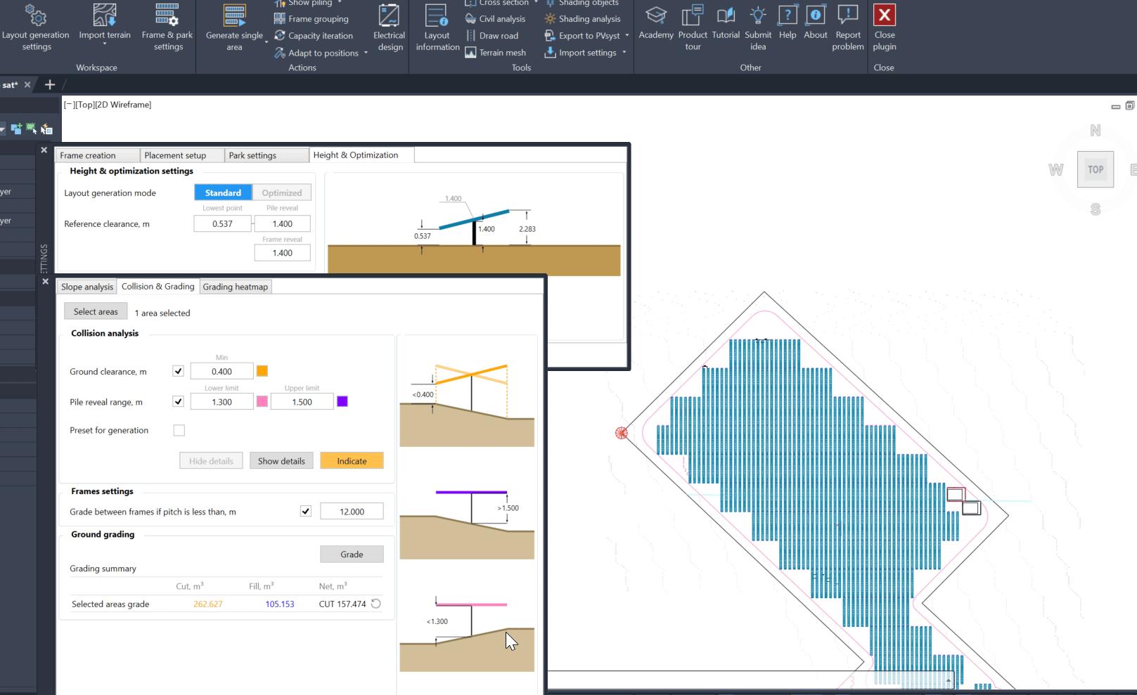
Once the project settings are configured, the automation tools generate layout options across the landscape. Engineers can review grading heatmaps, check collision alerts, and analyze row-to-row shading losses to optimize equipment placement and available land use.
After finalizing the physical structure, the user switches to the electrical design tools to assign strings, position combiner boxes, and calculate efficient cable routes across the site.
The platform then generates bills of materials, exports structural post schedules, and transfers the completed 3D model to PVsyst for detailed energy production analysis.
What You Can Manage with PVcase Ground Mount
- 3D Terrain Surfaces: Detailed digital land models created from LiDAR data, drone point clouds, digital elevation models, and topographical surveys.
- System Layout Designs: Accurate 2D and 3D fixed-tilt or single-axis tracker layouts customized for specific land parcels.
- Structural Pile Schedules: Complete spreadsheets containing coordinates, elevations, reveal heights, and custom post lengths for thousands of foundation piles.
- Electrical Collection Networks: Automated string layouts, combiner configurations, and terrain-optimized DC and AC cable routing.
- Civil Engineering Deliverables: Site grading assessments, cut-and-fill calculations, slope analysis, and structural clash detection reports.
- Project Documentation: Bankable bills of materials, single-line diagrams, pile schedules, and shading scene exports for PVsyst.
FAQs
What does PVcase Ground Mount do?
PVcase Ground Mount is a specialized solar engineering plugin that operates directly inside AutoCAD. It automates the creation of 3D terrain models, utility-scale solar layouts, structural post schedules, electrical designs, and cable routes across uneven land.
Who is PVcase Ground Mount best for?
The platform is built for EPC engineering teams, solar developers, civil designers, and consultants planning large ground-mounted and utility-scale solar projects, typically over 1 MW. It is especially useful for teams working on uneven terrain where traditional 2D design methods could lead to extensive grading.
Is PVcase Ground Mount free?
No. PVcase Ground Mount is commercial software offered through a paid enterprise subscription. Organizations must request a consultation, demonstration, or trial to receive a custom quote.
Does PVcase Ground Mount support integrations?
Yes. PVcase Ground Mount operates as an Autodesk AutoCAD plugin and supports integrations with PVsyst, GIS data sources, PVcase Prospect, and PVcase Yield. It can also work with DWG, DXF, LiDAR, DEM, and point-cloud data.
What are the main limitations of PVcase Ground Mount?
PVcase Ground Mount cannot operate as a standalone application because it requires an active Autodesk AutoCAD license. It also lacks transparent public pricing and depends on accurate LiDAR, drone, or topographic survey data to deliver its full terrain-modeling benefits.
What are the best alternatives to PVcase Ground Mount?
Common alternatives include RatedPower, HelioScope, AutoCAD Civil 3D with custom scripts, and other utility-scale solar design platforms. The best option depends on project size, terrain complexity, electrical design requirements, and existing engineering workflows.