PVcase Prospect
Pros
- Combines GIS, grid, environmental, and property data within one platform.
- Reduces the time required for manual property and site research.
- Provides an approachable interface that does not require extensive GIS expertise.
- Scales efficiently, allowing teams to evaluate large numbers of potential sites.
- Reduces project risk by identifying environmental and technical constraints early.
- Simplifies collaboration through data exports for engineering and real estate teams.
Cons
- Pricing is not publicly available and requires direct contact with the sales team.
- Advanced technical layouts must still be completed in desktop tools such as AutoCAD.
- Costs may become significant for large corporate teams with many users.
- The accuracy and depth of results depend partly on the quality of local public data.
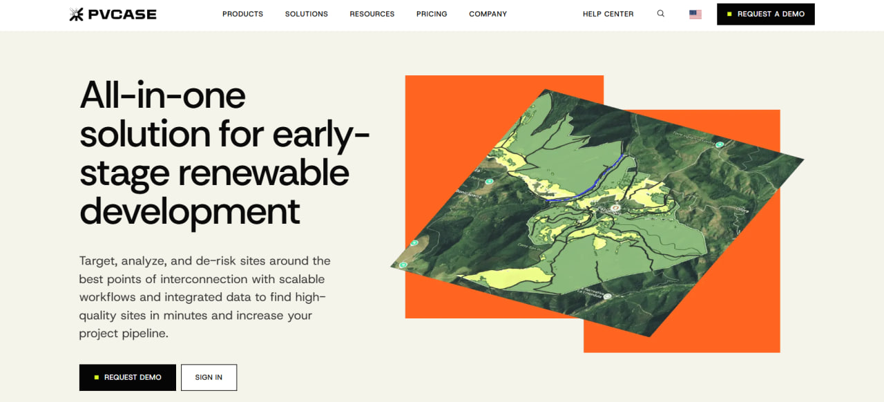
In the early stages of a solar project, developers often find themselves dealing with scattered data and slow, manual property searches—a combination that adds serious risk before engineering even begins. PVcase Prospect addresses this challenge by bringing GIS mapping, zoning details, and grid infrastructure into a single, cohesive platform. By providing clear environmental and utility data, the software helps teams identify viable development sites more quickly.
Finding the right piece of land can determine the long-term success and profitability of a utility-scale or commercial solar project. That is why many teams use PVcase Prospect to accelerate research and conduct early due diligence with greater confidence. This review covers its main features, pricing approach, and daily workflow to help you determine whether it fits your project pipeline.
What Is PVcase Prospect?
PVcase Prospect is a specialized web-based platform designed to streamline site screening, terrain evaluation, and early design checks. It falls within the solar design and engineering software category and is intended for renewable energy developers, project managers, land acquisition teams, and analysts who require location-based filtering.
The software combines public and premium mapping data—including property boundaries, power grids, and terrain slopes—within an interactive map interface. Instead of using complex GIS systems or switching between multiple data sources, users can apply constraint models and calculate buildable acreage directly from a web browser.
Features
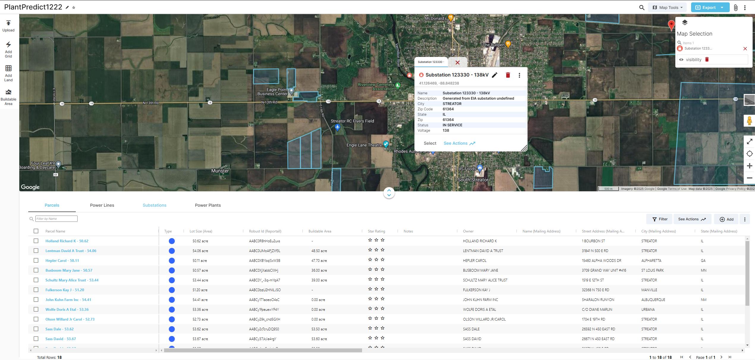
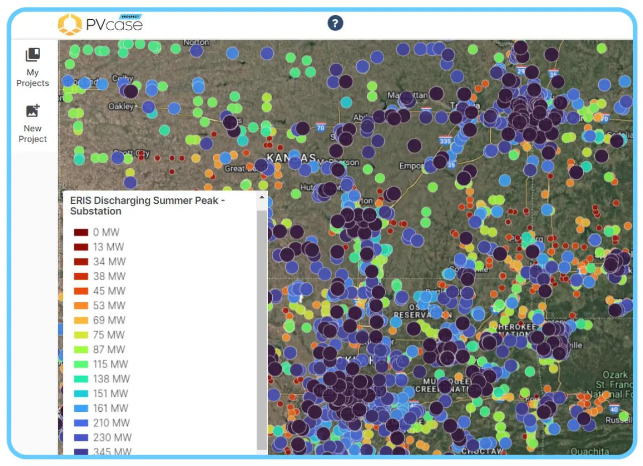
- Grid infrastructure mapping: Helps users locate nearby high-voltage power lines and substations on the map to evaluate potential grid connection options.
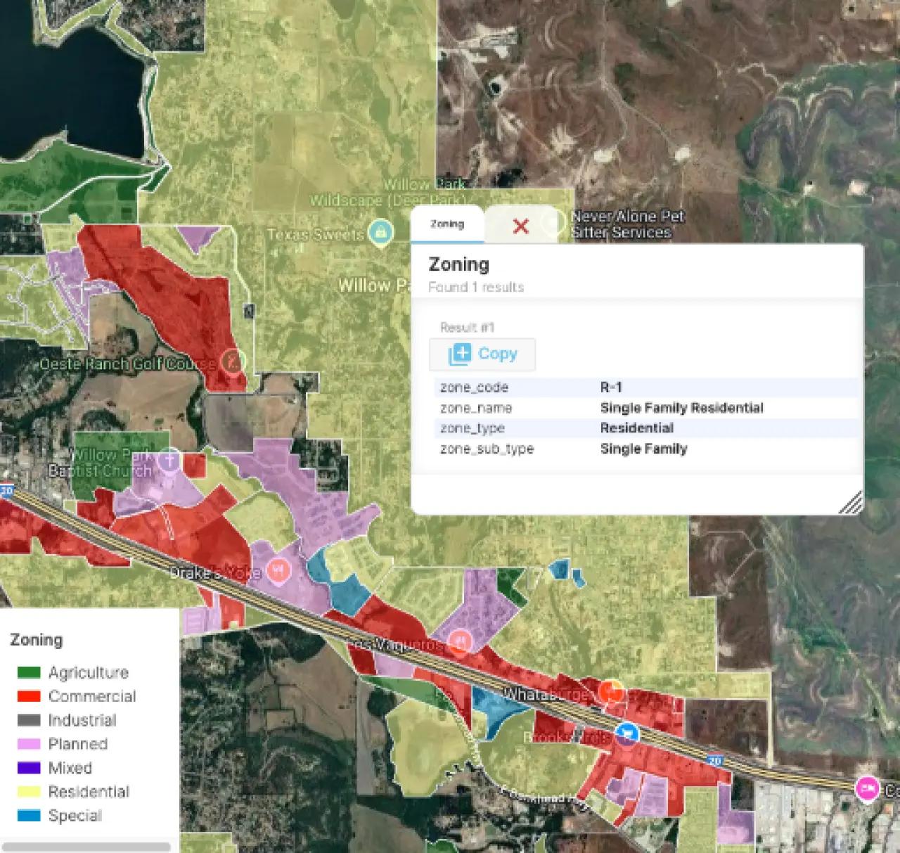
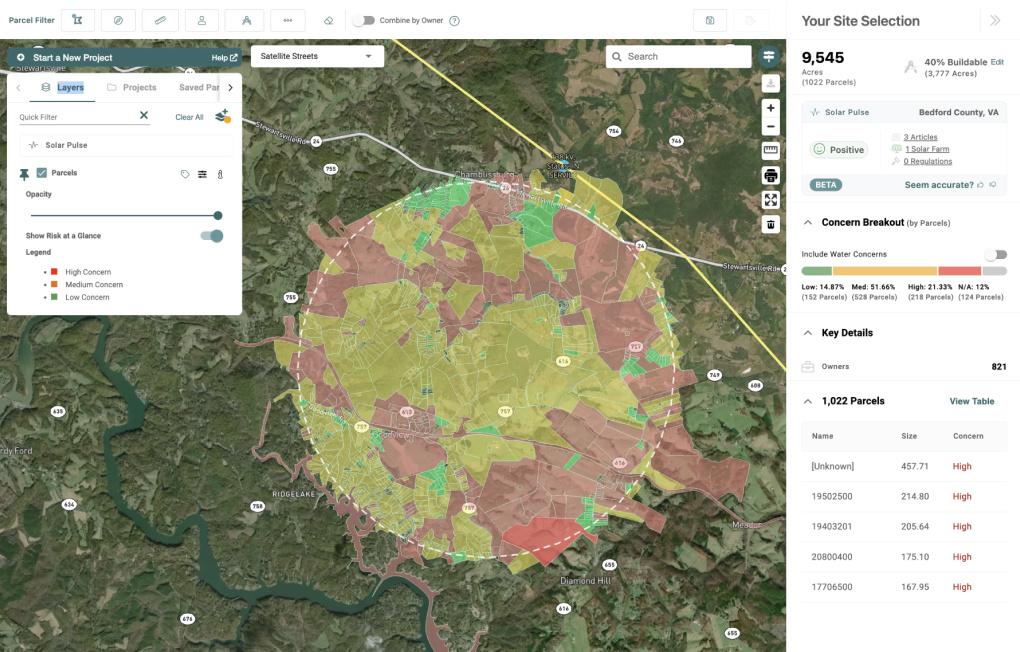
- Land and parcel boundary searching: Provides access to property boundaries, parcel configurations, and available ownership information for land acquisition research.
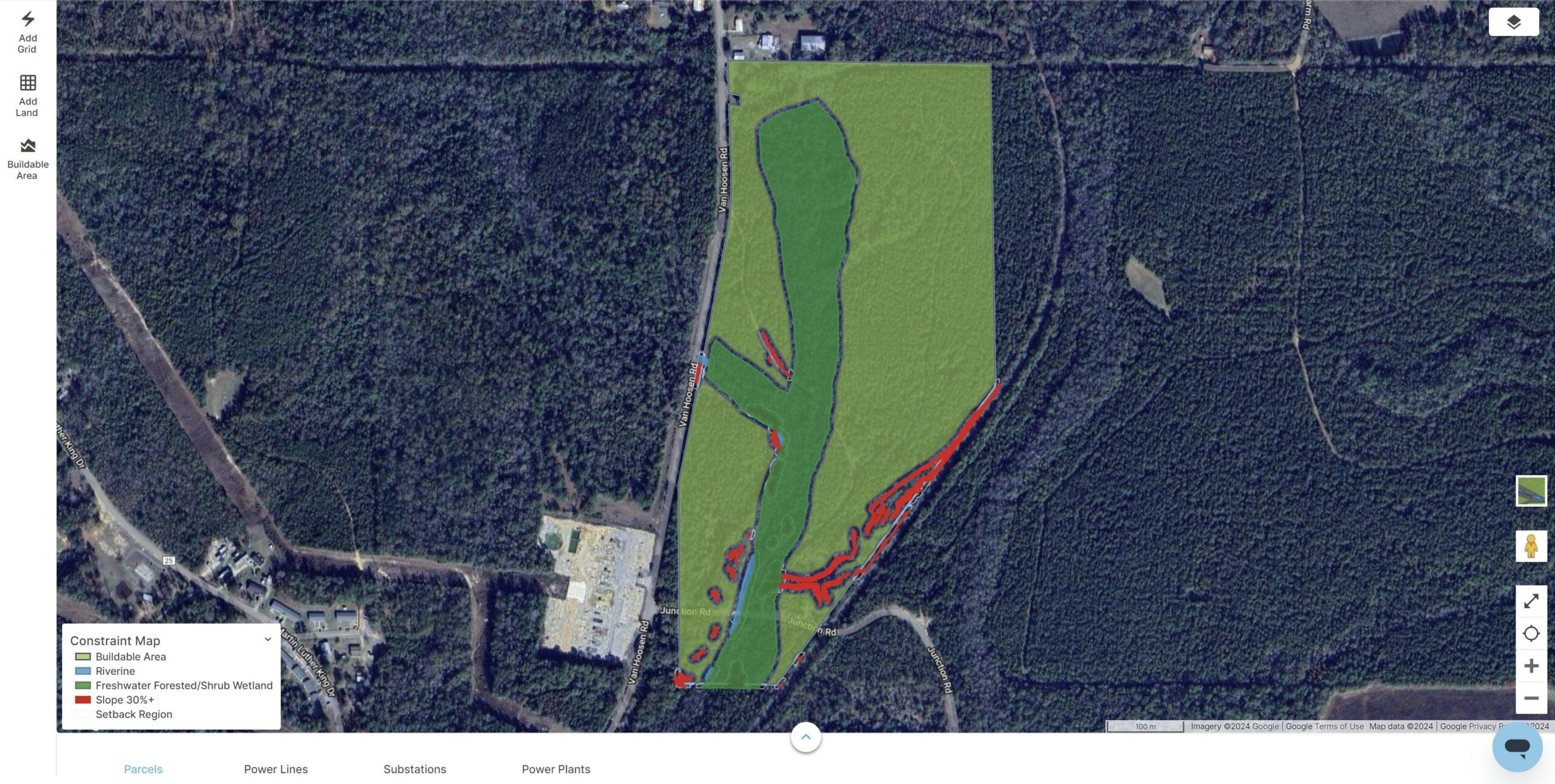
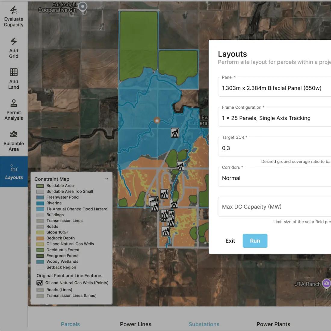
- Constraint mapping and hazard analysis: Allows users to map setbacks, steep slopes, wetlands, and other environmental constraints to calculate the actual buildable area.
- Automated layout and simulation: Generates preliminary designs and automated site layouts to estimate potential capacity and energy yield.
- Portfolio site tracking: Provides a centralized workspace where teams can monitor multiple prospective sites across different review stages.
- Data import and export: Allows teams to import custom files and mapping layers and export results to downstream tools such as AutoCAD for detailed engineering work.
Screenshots
PVcase Prospect Pricing
PVcase does not publish standard pricing on its website. Interested teams must contact the sales department or book a personalized product demonstration to receive a quote.
Exact rates depend on the customer’s location, number of users, and selected PVcase products. Industry reports suggest that PVcase packages may cost approximately $2,990 per user annually when bundled with design add-ons, although the price of PVcase Prospect as a standalone product may differ.
There is no permanent free version. PVcase may offer a two-week trial and special academic licensing options for students, researchers, and educational institutions through its academy program.
Integrations
Public information about third-party integrations is limited, so prospective customers should confirm compatibility with their existing workflows before purchasing.
The platform supports external design layers, custom datasets, and cloud-based workflows. It also connects with other products in the PVcase ecosystem, allowing geographic data and site boundaries to move into tools such as PVcase Ground Mount and PVcase Roof Mount.
How to Set Up PVcase Prospect
- Book a discovery call or live product demonstration through the official PVcase website.
- Complete the licensing agreement and provide your team’s account details to the sales representative.
- Use the setup link sent by email to create your secure user profile.
- Log in to the cloud-based dashboard using a modern desktop web browser.
- Import any proprietary local layers, project boundaries, or custom datasets you want to use.
- Create team workspaces and configure access permissions for your colleagues.
How to Use PVcase Prospect
An analyst typically begins by defining a search area based on utility lines or potential grid connection points. Using the interactive map, the developer filters locations according to terrain, proximity to substations, and slope angles. If a property appears suitable, the user can draw or generate a preliminary layout overlay to estimate how many solar panels or megawatts the land could accommodate.
As the review continues, team members can add constraints such as historical zones, wildlife habitats, wetlands, and required setbacks. The platform automatically updates the net buildable acreage as these restrictions are applied.
Once a site passes the initial screening stage, the developer can export parcel details, constraint data, and preliminary calculations for engineering, real estate, or investment teams to review.
What You Can Manage with PVcase Prospect
- Site suitability metrics: High-level indicators showing how practical a project may be based on terrain, constraints, and distance to the grid.
- Constraint maps: Digital boundaries identifying setbacks, restricted areas, no-build zones, and difficult topography.
- Buildable acreage reports: Calculations comparing the total property area with the land that can realistically be used for solar development.
- Interconnection queue trackers: Views for monitoring nearby projects and relevant electrical infrastructure.
- Site portfolios: Shared workspaces for organizing notes, ownership details, datasets, and review stages for every prospect in the development pipeline.
FAQs
What does PVcase Prospect do?
PVcase Prospect is a web-based GIS tool that helps solar developers discover, filter, and evaluate land for renewable energy projects. It supports early-stage risk analysis by displaying grid infrastructure, topography, environmental constraints, and property boundaries on detailed maps.
Who is PVcase Prospect best for?
The platform is designed for renewable energy developers, land acquisition managers, project managers, and investment analysts. It is particularly useful for teams that need to evaluate utility-scale or commercial solar sites quickly without relying entirely on dedicated GIS specialists.
Is PVcase Prospect free?
No, PVcase Prospect does not have a permanent free version. Interested organizations may request a two-week trial, while students, researchers, and educational institutions can contact PVcase about academic licensing options.
What are the main limitations of PVcase Prospect?
The company does not publish its pricing, making it difficult to compare costs without contacting the sales team. Although the platform is useful for identifying and sizing sites, final permit-ready engineering plans must still be completed in an external CAD environment.
What are the best alternatives to PVcase Prospect?
Common alternatives include traditional GIS tools such as ArcGIS and solar design platforms such as Aurora Solar and OpenSolar. The best choice depends on whether a team primarily needs detailed land screening, technical system design, or financial proposal generation.