PVX.AI
Pros
- Reduces repetitive drafting by combining grading, layout creation, and electrical routing inside one CAD environment.
- Accurate terrain maps help prevent earthwork mistakes and reduce unnecessary grading.
- Speeds up electrical design by allowing users to compare Line, U-shape, Leapfrog, and other string configurations.
- Improves energy simulation accuracy because the design and analysis stages use the same terrain model.
- Simplifies onboarding for CAD technicians by keeping the workflow inside familiar software.
- Supports field handoffs through CSV coordinate exports and shareable Google Earth KML files.
Cons
- Requires an active AutoCAD or BricsCAD license, adding third-party software costs.
- Focuses on large ground-mounted utility projects and offers limited value for commercial or residential rooftop designs.
- May involve a learning curve for engineers who are not accustomed to using complex terrain data during early project phases.
- Final results depend heavily on the accuracy of the topographic maps, LiDAR scans, or drone survey data supplied to the platform.
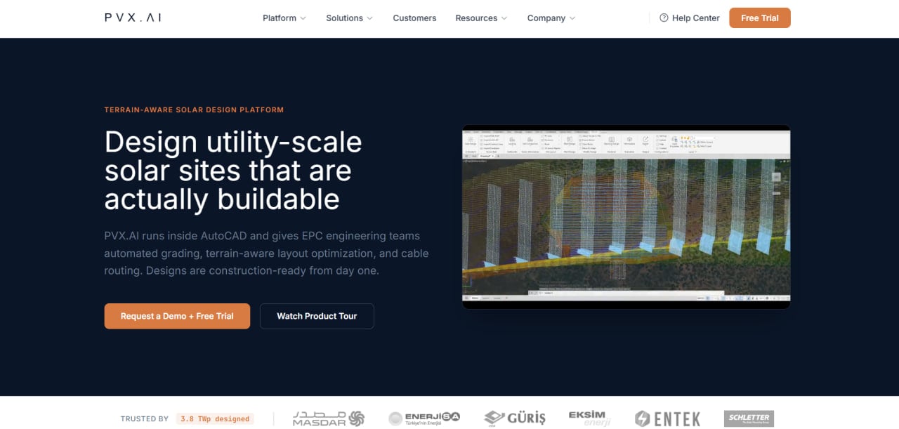
Designing massive solar farms on uneven ground can be a major headache. Most layout tools treat the ground as completely flat, which can lead to expensive grading surprises, unbuildable areas, and budget increases later in the project. PVX.AI addresses this problem by adding terrain awareness to the early design process, reducing the need for endless manual adjustments.
Whether you are a field engineer, CAD technician, or project manager, this tool helps you deliver reliable, audit-ready blueprints. By connecting the layout to the real-world shape of the land, teams can make informed decisions early—balancing earthwork costs against electrical layout efficiency.
What Is PVX.AI?
PVX.AI is a professional extension designed to operate directly inside AutoCAD and BricsCAD. It functions as a specialized solar design and civil engineering platform that helps EPC firms and developers plan solar parks through every project phase, from initial feasibility studies to final construction blueprints.
The system uses a terrain-focused engine divided into two components:
- PVX.Cad: Handles drafting, layout generation, grading analysis, electrical routing, and engineering documentation.
- PVX.View: Provides interactive 3D models and project analysis for clients, managers, and other stakeholders.
Solar engineering teams worldwide have used PVX.AI to design more than 3.8 TWp of solar capacity.
Features
- Terrain-First Automated Grading: Analyzes slopes and calculates cut-and-fill volumes directly from site data, helping teams avoid costly construction changes later.
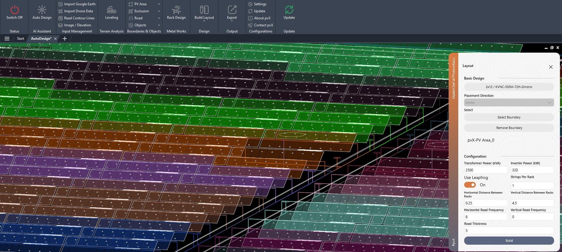
- Layout Optimization: Automatically fills project areas with rows and racking systems that conform to uneven terrain while respecting setbacks and exclusion zones.
- Automated Cable Routing: Maps electrical routes along trench paths, calculates exact cable lengths, and allows engineers to compare different wiring strategies.
- DC Electrical Analysis: Calculates voltage drops and verifies 1,500 V system limits, helping ensure the Bill of Materials matches the physical cable routes.
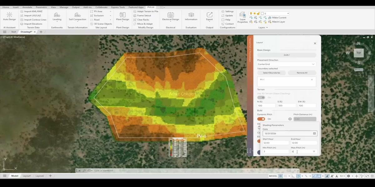
- Multi-Directional Terrain Mapping: Uses color-coded maps to display slope steepness and direction, making it easier to identify pile-driving risks and construction bottlenecks.
- 3D Site Visualization: Creates an interactive, web-based 3D project model that clients and non-technical stakeholders can review easily.
Screenshots
PVX.AI Pricing
PVX.AI uses a subscription-based pricing model designed to scale with a team’s workload. Exact enterprise pricing is not published, so prospective customers must contact the sales team for a custom quote.
Available licensing options generally include:
- Free Trial: A downloadable two-week trial that allows users to test the software with their own project files.
- Annual License: A per-seat annual subscription intended for teams with a consistent project pipeline.
- Pay-Per-Use Credits: Flexible usage credits for companies that only need the software for occasional or one-off projects.
Integrations
PVX.AI integrates with existing engineering and survey workflows to support smooth data transfers:
- CAD Environments: Works as a native plugin inside AutoCAD and BricsCAD, using familiar layers, blocks, commands, and keyboard shortcuts.
- PVsyst Integration: Exports project geometry through PVCollada files and imports PVsyst layouts back into CAD drawings without losing important details.
- GIS Tools: Supports KML and KMZ files for importing property boundaries, roads, environmental restrictions, and exclusion areas.
- Construction and Survey Equipment: Imports drone data, LiDAR point clouds, and terrain contours while exporting exact pile coordinates to CSV files.
How to Set Up PVX.AI
- Visit the official website to request a live demonstration or download the two-week free trial.
- Open the installation file provided by the PVX.AI support team.
- Install the plugin and activate the product key inside AutoCAD or BricsCAD.
- Open the CAD workspace and confirm that the new PVX tab appears in the top toolbar.
- Configure the preferred coordinate system, measurement units, default layers, and layer colors.
How to Use PVX.AI
The workflow begins by importing survey data, such as drone maps, LiDAR files, terrain contours, or LandXML surfaces, into a CAD drawing. The user then draws or imports site boundaries, access roads, environmental exclusions, and setback zones.
Once the project boundaries are defined, the layout engine automatically places trackers or fixed-tilt racking systems across the digital terrain model. The rows follow the actual slopes of the land while respecting the specified design rules.
The user then moves to electrical routing, using semi-automated tools to draw trenches, compare string configurations, calculate cable lengths, and evaluate voltage drops.
After finalizing the layout, the design can be exported to PVsyst for detailed energy yield analysis or uploaded to PVX.View to create an interactive project dashboard for clients and stakeholders.
What You Can Manage with PVX.AI
- Engineering Blueprints: Create and export standard DWG and DXF files with organized layer structures and intelligent block details.
- Earthwork Metrics: Manage LandXML surfaces, calculate cut-and-fill balances, and generate grading stake information.
- Electrical Schematics: Compare voltage drop calculations and evaluate different string layouts and cable routes.
- Construction Packages: Generate CSV files containing GPS coordinates, elevations, and exact installation heights for structural piles.
- Client Deliverables: Share interactive project links, PDF shading charts, and georeferenced Google Earth overlays.
FAQs
What does PVX.AI do?
PVX.AI is an AutoCAD and BricsCAD plugin that allows utility-scale solar designers to create layouts directly on real-world terrain data. It automates grading calculations, row placement, electrical routing, and construction documentation without requiring users to leave their CAD environment.
Who is PVX.AI best for?
PVX.AI is designed for EPC engineering teams, solar developers, CAD technicians, civil engineers, and estimators planning large ground-mounted solar arrays on complex or sloped terrain.
Is PVX.AI free?
No. PVX.AI is a premium commercial platform, but it offers a downloadable two-week trial so teams can test the software before purchasing a license.
Does PVX.AI support integrations?
Yes. PVX.AI integrates with AutoCAD, BricsCAD, PVsyst, GIS files, LiDAR data, drone surveys, LandXML surfaces, and construction coordinate exports in CSV format.
What are the main limitations of PVX.AI?
PVX.AI cannot operate as a standalone application because it requires an active AutoCAD or BricsCAD license. It is also designed specifically for ground-mounted projects and is not suitable for most rooftop solar layouts.
What are the best alternatives to PVX.AI?
Common alternatives include PVcase Ground Mount, Helios 3D, RatedPower, and PVFARM. The best option depends on terrain complexity, CAD preferences, collaboration requirements, and project scale.