DroneDeploy
Pros
- User-friendly interface that makes drone operations accessible to users without advanced piloting experience.
- Fast cloud-based processing for photogrammetry, maps, and 3D models.
- Robust mobile application compatible with many popular drone models.
- Comprehensive functionality covering aerial, ground, and interior reality capture.
- Strong security features and Enterprise-level user management.
- Large user community with extensive training and support documentation.
- Progress AI helps automate site change detection and construction tracking.
Cons
- Higher starting price than some specialized drone mapping competitors.
- Per-user pricing can become expensive as organizations add more team members.
- Large datasets may experience processing delays during periods of high platform demand.
- Advanced functionality such as thermal inspections and vertical mapping requires higher-tier subscriptions.
- Cloud processing requires a reliable and sufficiently fast internet connection for large uploads.
- Hardware compatibility may be more limited for users operating drones outside the most widely supported brands.
Enterprise operations in industries such as construction, energy, and agriculture often face challenges when tracking progress across large physical sites. Traditional manual inspections are time-consuming, prone to human error, and may expose personnel to significant safety risks.
DroneDeploy addresses these problems by providing a unified reality capture platform that automates data collection using drones and ground-based devices. By converting raw imagery into high-resolution maps, 3D models, and actionable insights, the software allows teams to monitor site quality, progress, and safety remotely. This provides stakeholders with a centralized and accurate source of project information.
What Is DroneDeploy?
DroneDeploy is a cloud-based reality capture, drone mapping, and industrial inspection platform. It helps businesses capture, process, and analyze data from physical sites to create digital twins of buildings, infrastructure, land, and other assets.
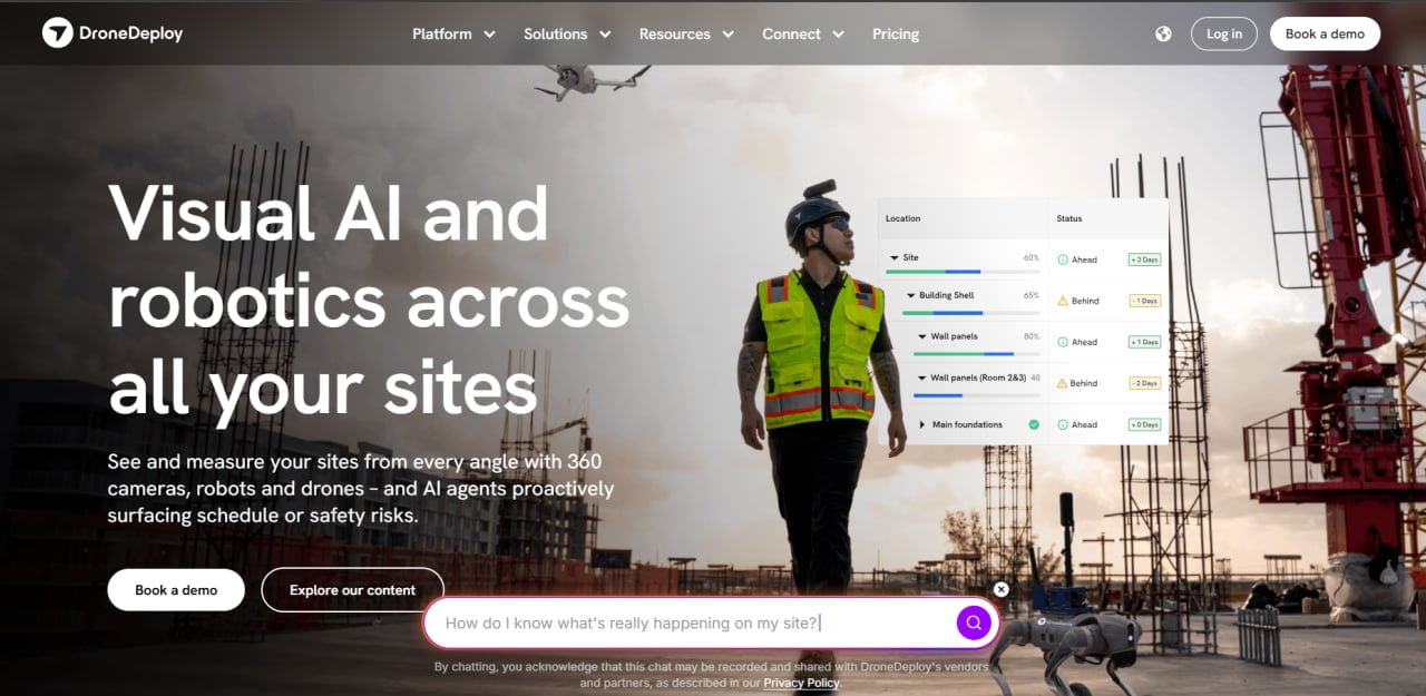
Although DroneDeploy was originally known primarily for drone mapping, it has developed into a broader reality capture platform that combines aerial imagery with 360-degree cameras and ground robotics.
The software is primarily used by project managers, VDC (Virtual Design and Construction) teams, drone operators, surveyors, and field engineers. It supports industries such as construction, renewable energy, agriculture, mining, roofing, and insurance.
DroneDeploy reports that its platform is used by more than 5,000 enterprises and has supported the mapping of over 400 million acres.
DroneDeploy Features
Automated Flight Planning
Allows users to create and pre-program drone flight paths on mobile devices. This ensures consistent and repeatable data capture without requiring manual piloting throughout the entire mission.
3D Modeling and Mapping
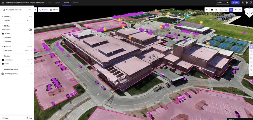
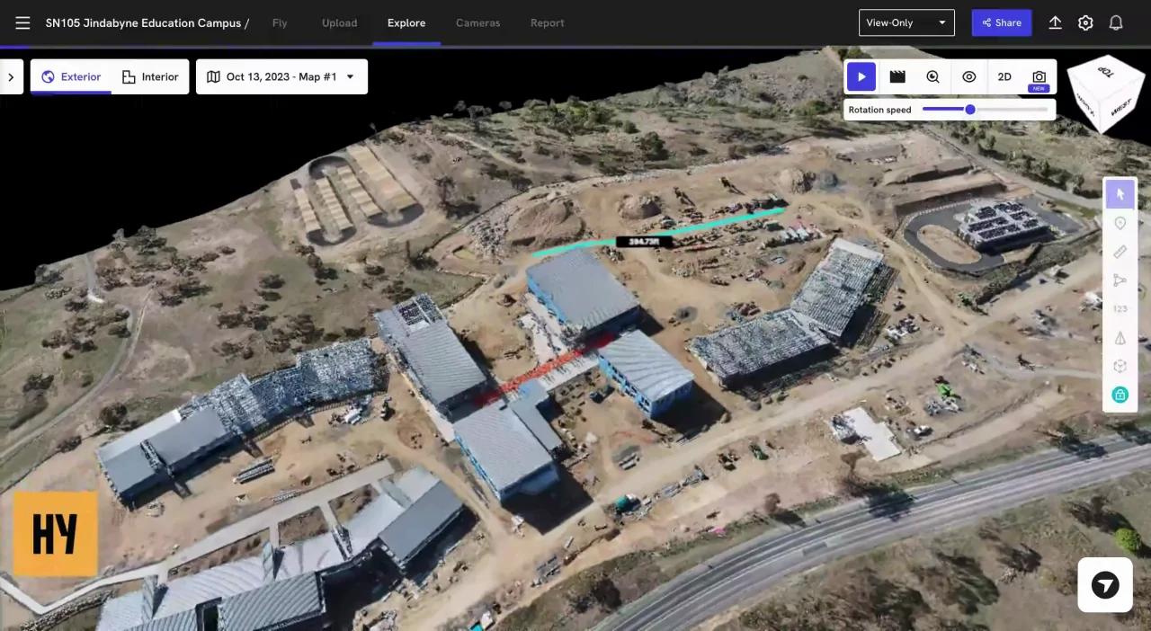
Processes aerial imagery to generate detailed orthomosaic maps, point clouds, elevation models, and 3D site representations.
Progress AI
Uses artificial intelligence to detect and track changes across a site over time. This helps teams identify construction progress, incomplete work, and potential deviations from project plans.
Unified Reality Capture
Combines drone imagery, 360-degree site walkthroughs, and ground robot data within a single dashboard to provide comprehensive site visibility.
Roof Reporting
Uses high-resolution imagery to prepare roof reports containing measurements, surface information, and damage assessments. This can be faster and safer than traditional manual roof inspections.
Stockpile Analysis
Provides tools for calculating the volume and estimated weight of materials stored on-site, supporting inventory management and financial reporting.
Thermal Inspection
Supports compatible thermal sensors for identifying heat signatures. This functionality can be used to inspect solar modules, roofs, electrical equipment, and building envelopes.
Screenshots

DroneDeploy Pricing
DroneDeploy offers several pricing tiers based on the number of users, required functionality, image volume, and level of support.
Individual Plan
The Individual plan costs approximately $329 per month when billed annually or around $499 with monthly billing. It is limited to one user and includes basic mapping functionality with up to 3,000 images per map.
Advanced Plan
The Advanced plan costs approximately $599 per month when billed annually. It adds functionality such as vertical mapping, thermal inspections, and higher image limits.
Teams Plan
The Teams plan is intended for organizations that require multiple users, centralized project management, collaboration tools, and administrative controls. Pricing is available upon request.
Enterprise Plan
The Enterprise plan provides custom functionality for large organizations, including advanced user management, single sign-on, API access, customized integrations, and dedicated support. Pricing is not publicly listed.
Free Trial
DroneDeploy generally offers a limited free trial that allows prospective users to evaluate flight planning and basic mapping features before purchasing a subscription.
DroneDeploy Integrations
DroneDeploy offers an application marketplace with more than 80 integrations for construction, engineering, storage, GIS, and agricultural workflows.
Project Management Integrations
- Procore: Connects reality capture data with construction project management workflows.
- Autodesk Construction Cloud: Supports coordination with BIM 360 and Autodesk construction projects.
- Bluebeam: Helps teams incorporate site information into document review and markup workflows.
Storage and Collaboration Integrations
- Microsoft OneDrive
- Google Drive
- Box
- Dropbox
GIS and Engineering Software
- QGIS: Supports the use of exported mapping data in open-source GIS workflows.
- ArcGIS: Allows processed geospatial data to be used in Esri mapping environments.
- AutoCAD: Supports exports for engineering, design, and construction documentation.
Agricultural Integrations
DroneDeploy integrates with John Deere Operations Center to support field monitoring, crop analysis, and agricultural operations.
API Access
Enterprise customers can access the DroneDeploy API to create custom connections, automate data transfers, and build internal processing workflows.
How to Set Up DroneDeploy
- Create an account on the DroneDeploy website and download the mobile application.
- Select a paid subscription or begin an available free trial.
- Check the hardware compatibility list to confirm that your drone, camera, or ground capture device is supported.
- Create a new project and define the site boundaries on the digital map.
- Grant the required permissions for DroneDeploy to connect with the drone controller and mobile device.
- Configure flight altitude, image overlap, camera settings, and other mission parameters.
- Synchronize project settings between the web dashboard and mobile application.
- Invite team members and configure their access permissions if using a multi-user plan.
How to Use DroneDeploy
A typical DroneDeploy workflow begins with a user opening the mobile application at the project site and selecting a previously configured flight mission. After completing the required safety checks, the drone takes off automatically and follows the planned route while capturing overlapping photographs.
When the flight is complete, the user uploads the imagery to the DroneDeploy cloud platform for processing. The system converts the images into an orthomosaic map, point cloud, elevation model, or 3D site representation.
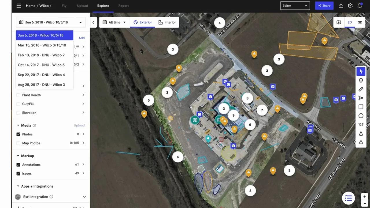
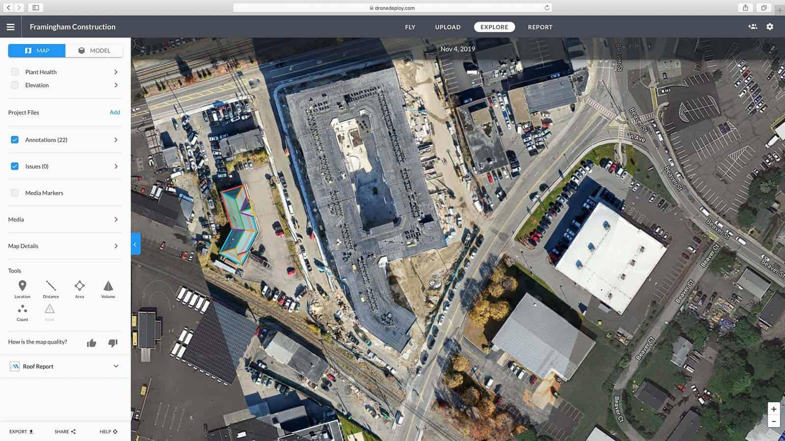
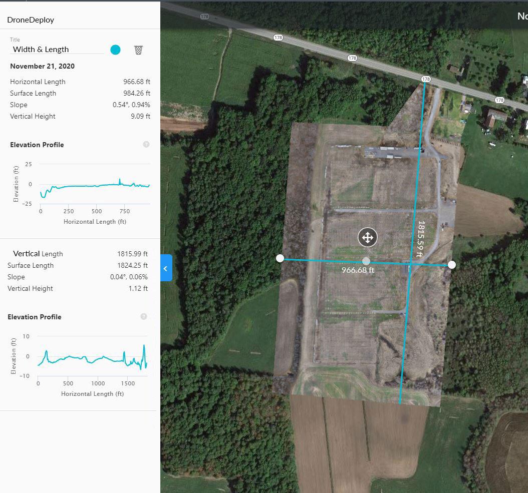
Project managers can then access the processed data through the web dashboard. They can use measurement tools to calculate distances, areas, slopes, and stockpile volumes.
If the site has been captured multiple times, users can compare maps from different dates to evaluate construction or operational progress. AI-based tools can help identify changes and deviations across the site.
The completed maps, models, and reports can be exported or shared with customers, subcontractors, engineers, and other project stakeholders.
What You Can Manage with DroneDeploy
- Digital Twins: Create detailed 3D representations of physical sites, buildings, and infrastructure.
- Construction Progress: Build visual timelines that document projects from initial site preparation to completion.
- Inventory Data: Measure stockpiles and raw materials for operational and financial reporting.
- Inspection Records: Organize structural, equipment, roof, solar, and thermal inspection information.
- Safety Audits: Use high-resolution visual evidence to identify and document potential site hazards remotely.
- Roof and Facade Reports: Prepare detailed assessments for maintenance planning, construction, and insurance claims.
DroneDeploy FAQs
What does DroneDeploy do?
DroneDeploy automates the capture and processing of aerial and ground data to create maps, 3D models, and digital twins. Its analysis tools help businesses track project progress, perform inspections, measure materials, and manage site safety.
Who is DroneDeploy best for?
DroneDeploy is designed for teams in construction, energy, agriculture, mining, roofing, and other industries that need to monitor large physical sites. It is particularly valuable for companies seeking a unified platform for drone flights, data processing, inspections, and team collaboration.
Is DroneDeploy free?
DroneDeploy may provide a limited free trial, but its professional mapping, processing, collaboration, and analytics features require a paid subscription. There is no permanent free tier for advanced commercial use.
How much does DroneDeploy cost?
The Individual plan costs approximately $329 per month with annual billing or $499 with monthly billing. The Advanced plan costs approximately $599 per month when billed annually. Teams and Enterprise pricing is available upon request.
What are the main limitations of DroneDeploy?
The main limitations are its relatively high cost for individuals and small teams, as well as its reliance on a stable internet connection for uploading and processing data. Some specialized mapping and inspection features are also restricted to more expensive plans.
What are the best alternatives to DroneDeploy?
Common DroneDeploy alternatives include Pix4D, Propeller, and Site Scan for ArcGIS. OpenSpace and HoloBuilder may be considered for teams focused primarily on ground-based construction documentation and 360-degree site capture.