Glint Solar

Pros
- Significantly reduces site screening time.
- Centralizes fragmented GIS and solar resource data.
- Excellent 3D visualizations for stakeholder presentations.
- Supports collaboration between development and engineering teams.
- Useful for solar-plus-storage and Agri-PV projects.
- Cloud-based platform accessible from anywhere.
Cons
- No transparent public pricing.
- Focused mainly on early-stage project development.
- Advanced GIS layer management may require training.
- Not designed for residential solar projects.
Kicking off a large-scale solar project often hits a major roadblock right at the start: finding the right piece of land. Developers frequently deal with scattered GIS data, slow manual screening processes, and expensive feasibility studies for sites that may never move forward. These early-stage bottlenecks create delays and increase project development risks.
Glint Solar solves these challenges with a cloud-based GIS and solar design platform built specifically for utility-scale renewable energy projects. By combining mapping data, automated screening tools, and preliminary design capabilities, the platform helps development teams identify profitable opportunities much faster.
What Is Glint Solar?
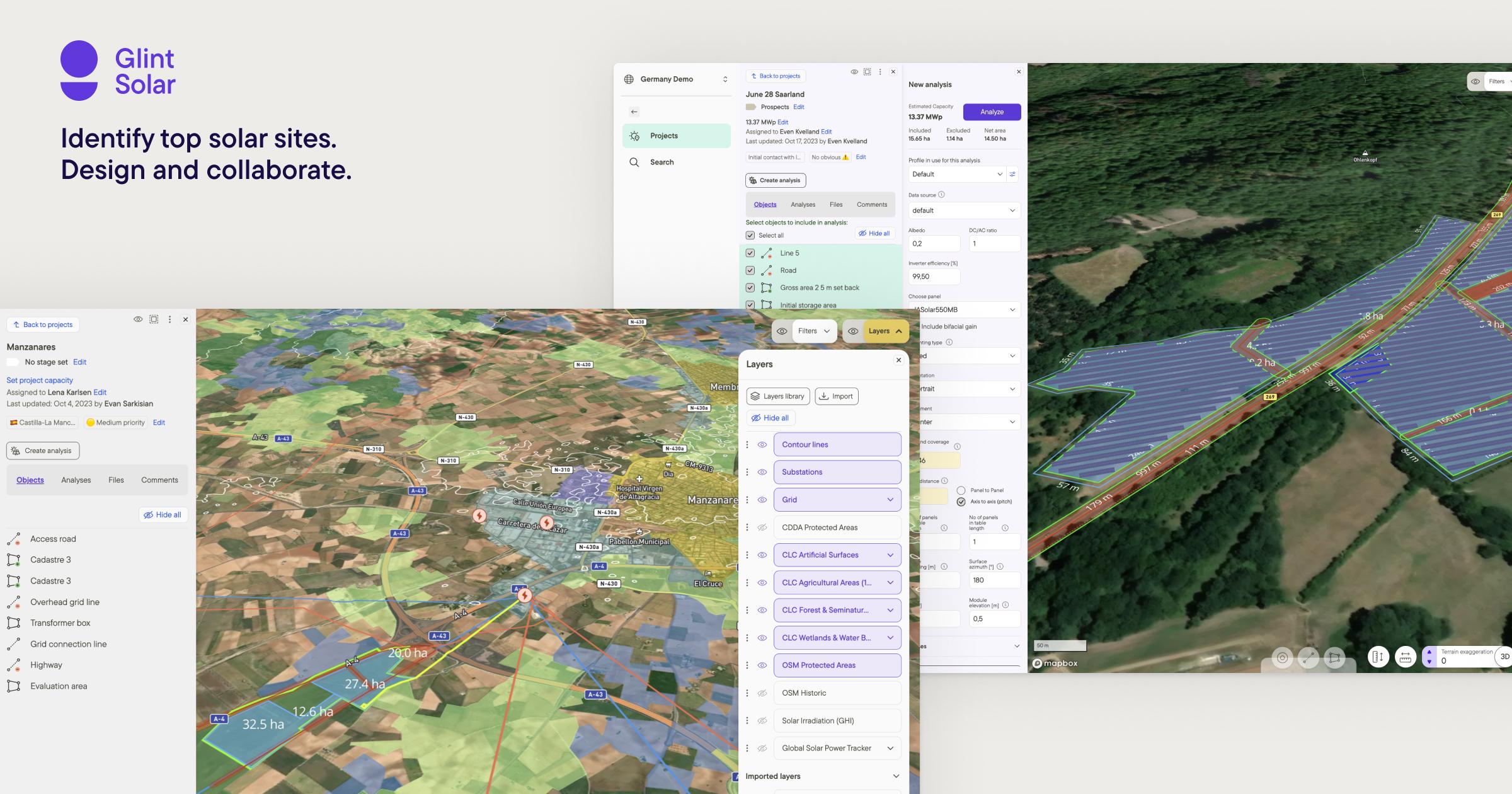
Glint Solar is a Software-as-a-Service (SaaS) platform focused on utility-scale solar, battery energy storage systems (BESS), and hybrid renewable energy project development.
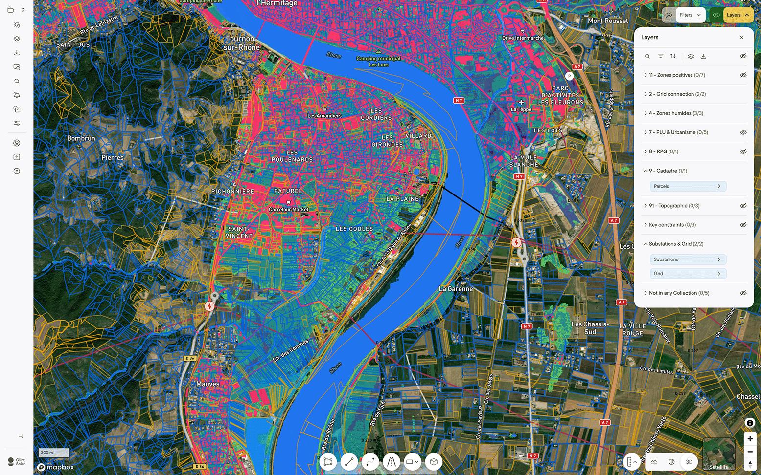
The platform centralizes GIS layers, satellite imagery, terrain data, environmental constraints, and solar design tools into one workspace where developers can screen sites, create layouts, and estimate project feasibility.
Features
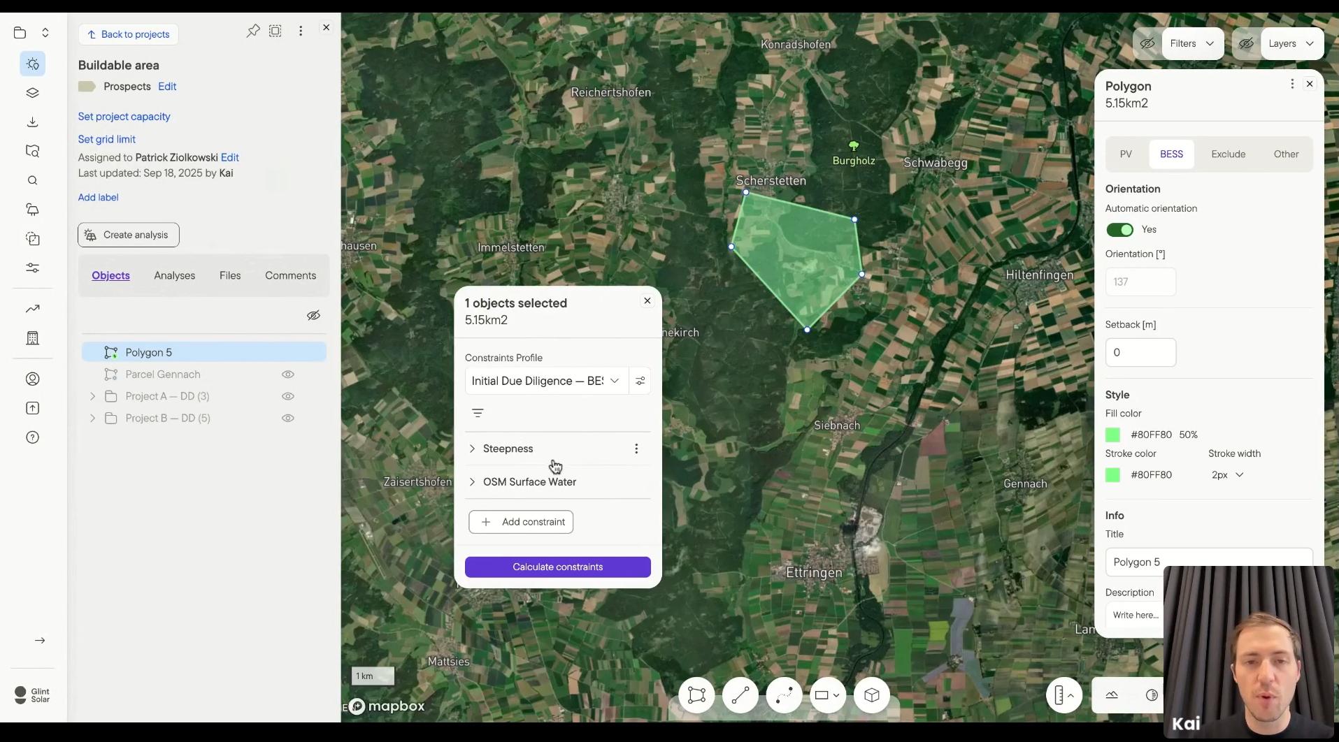
- Smart Site Screening: Filter land parcels using terrain, grid proximity, environmental zones, and other criteria.
- Integrated GIS Library: Access grid infrastructure, topography, protected areas, and land-use layers.
- 3D Project Visualization: Generate realistic 3D solar park visualizations for stakeholders and permitting.
- Automated Buildable Area Calculation: Automatically apply setbacks and exclusion zones.
- Preliminary Solar and BESS Layout Design: Create utility-scale project layouts quickly.
- Energy Yield Forecasting: Estimate production potential using weather and irradiation data.
- PV Degradation Mapping: Analyze environmental conditions affecting panel performance.
- Collaboration Workspace: Centralize notes, files, and project communication.
Screenshots
Glint Solar Pricing
Glint Solar does not publish public pricing and instead provides custom enterprise quotes.
- Custom Pricing: Pricing depends on project scale and team size.
- Demo Access: Companies can request personalized product demonstrations.
- Enterprise Plans: Flexible packages for developers, GIS teams, and engineering groups.
- No Public Free Version: The platform currently does not offer a free self-service plan.
Integrations
Glint Solar integrates with solar resource databases, GIS platforms, and engineering tools.
- Solar Data Providers: SolarAnywhere and Solargis integrations.
- Engineering Exports: DXF support for AutoCAD and engineering software.
- GIS Formats: KML, KMZ, and GeoJSON exports.
- Climate Modeling: Partnership with Norway’s Institute of Energy Technology (IFE).
How to Set Up Glint Solar
- Request a demo and discuss your project requirements.
- Select a subscription package based on your team size.
- Create a cloud workspace and configure company settings.
- Invite development, GIS, and engineering team members.
- Upload internal GIS files and project data.
- Start screening land using prospecting filters.
How to Use Glint Solar
Users begin by filtering potential development sites using GIS screening tools that evaluate terrain, solar irradiation, environmental constraints, and grid access.
Once a promising site is identified, developers create preliminary solar or battery layouts, run yield simulations, and generate visual reports for internal analysis, permitting, and stakeholder communication.
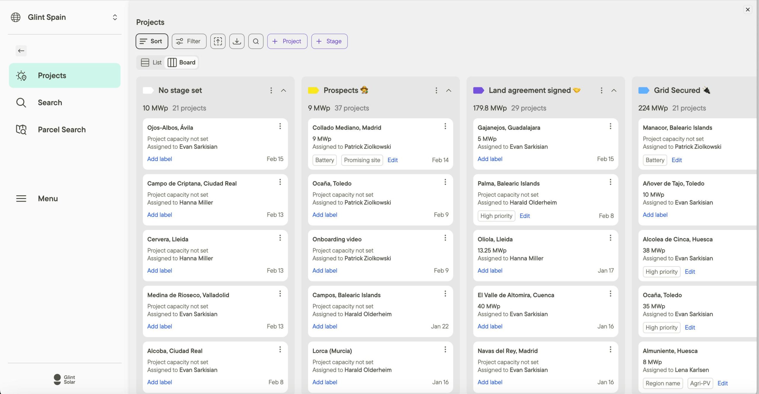
What You Can Manage with Glint Solar
- Site Identification: Discover suitable land for utility-scale renewable projects.
- Project Pipelines: Organize active and future development opportunities.
- Preliminary Solar Designs: Build early-stage solar and BESS layouts.
- Stakeholder Presentations: Create 3D visuals and feasibility reports.
- GIS Data Layers: Manage environmental, topographic, and infrastructure data.
- Feasibility Analysis: Evaluate production potential and project viability.
FAQs
What does Glint Solar do?
Glint Solar helps utility-scale renewable energy developers identify, screen, and analyze potential project sites using GIS and solar design tools.
Who is Glint Solar best for?
It is designed for utility-scale solar developers, independent power producers (IPPs), GIS specialists, and renewable energy project managers.
Is Glint Solar free?
No, Glint Solar is a commercial SaaS platform that requires custom pricing and demo-based onboarding.
What are the main limitations of Glint Solar?
Main limitations include its focus on early-stage development rather than detailed engineering and the lack of support for residential solar projects.
What are the best alternatives to Glint Solar?
Popular alternatives include RatedPower, PVcase, Solargis Prospect, and ArcGIS combined with custom solar analysis workflows.