Paces
Pros
- Significantly accelerates renewable site selection and due diligence.
- Centralizes grid, permitting, and environmental analysis.
- AI-driven zoning and permitting analysis reduces manual research.
- Improves collaboration between development teams.
- Makes GIS workflows more accessible for non-technical users.
- Helps eliminate high-risk sites early in the pipeline.
Cons
- No transparent public pricing.
- Formal onboarding process required before platform access.
- Advanced enterprise features may exceed smaller developer needs.
- Some datasets depend on third-party public information sources.
Building utility-scale renewable energy projects is often slowed down by fragmented datasets, complicated zoning regulations, environmental restrictions, and uncertain grid capacity. Developers traditionally spend months manually reviewing maps, permit rules, and utility documents before determining whether a project site is even viable. These delays increase development risk and waste valuable resources on sites that may never reach construction.
Paces solves this challenge with an AI-driven development platform that automates early-stage site selection and due diligence for renewable energy infrastructure. By combining GIS mapping, grid data, environmental analysis, and permitting intelligence into one cloud platform, Paces helps development teams identify high-potential sites dramatically faster than traditional workflows.
What Is Paces?
Paces is a cloud-based renewable energy development platform focused on site selection, permitting intelligence, and project pipeline management.
The platform uses GIS technology and “agentic AI” to automate complex early-stage development tasks such as zoning analysis, permitting research, environmental screening, and grid capacity assessment for utility-scale solar, wind, battery storage, EV charging, and data center projects.
Features
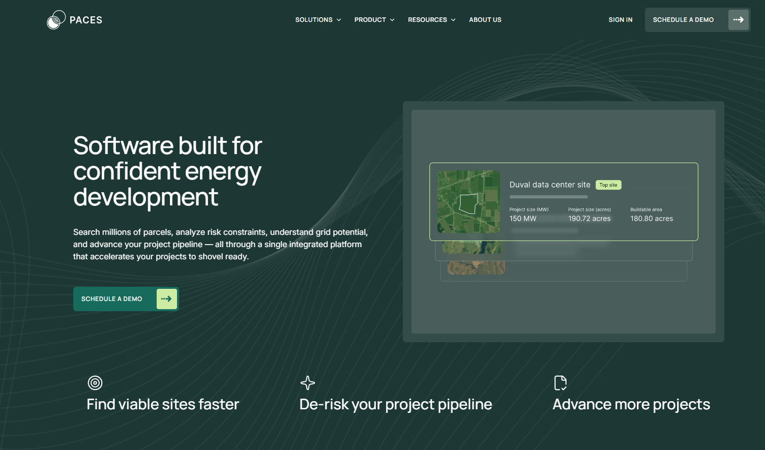
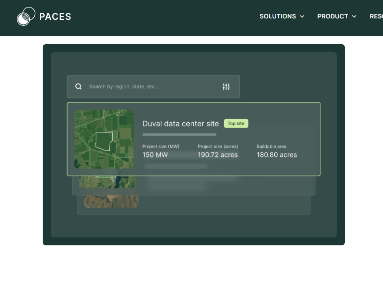
- Flexible Site Search: Filter millions of land parcels using criteria such as acreage, grid proximity, and land-use restrictions.
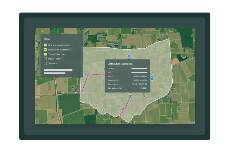
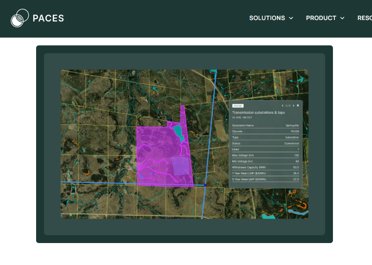
- Unified GIS Layers: View environmental, permitting, transmission, and utility data in one interface.
- AI-Powered Permitting Analysis: Scan local zoning laws and identify potential regulatory challenges automatically.
- Grid Capacity Analysis: Standardize utility hosting capacity data across different regions.
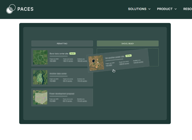
- Pipeline Management: Track renewable development projects from origination through site control.
- Custom Project Scoring: Rank opportunities based on risk, economics, and permitting complexity.
- Critical Issues Analysis: Generate professional due diligence reports across multiple risk categories.
Screenshots
Paces Pricing
Paces uses a custom enterprise pricing model designed for large-scale renewable energy developers.
- Demo Access: Personalized platform demonstrations available through sales consultations.
- Custom Quotes: Pricing depends on portfolio scale, user count, and required data layers.
- Annual Subscriptions: Enterprise subscription licensing for ongoing access.
- Add-On Services: Additional consulting and advanced risk analysis services available.
Integrations
Paces integrates with GIS systems, CRMs, and external energy datasets.
- CRM Integration: Salesforce synchronization for project and landowner workflows.
- GIS Exports: Export geospatial data into mapping and engineering tools.
- API Access: Build custom integrations and internal analytics systems.
- Government and Utility Data: Continuous updates from federal, state, local, and utility datasets.
How to Set Up Paces
- Book a demo and review your renewable development requirements.
- Select data layers and geographic regions relevant to your projects.
- Complete onboarding and workflow training with the Paces team.
- Configure custom site filters and risk scoring rules.
- Connect CRM systems such as Salesforce if needed.
- Begin site origination and project pipeline management.
How to Use Paces
Development teams typically begin by applying site selection filters to identify parcels that meet technical requirements for solar, wind, battery storage, or EV charging projects. Users can then review unified GIS layers to evaluate environmental restrictions, topography, transmission access, and permitting constraints.
AI-driven permitting analysis tools automatically scan zoning regulations and identify jurisdictions where projects may face approval difficulties. Once promising opportunities are identified, teams move sites into the project pipeline for further due diligence, landowner outreach, and interconnection analysis.
What You Can Manage with Paces
- Site Origination Pipelines: Track renewable projects from discovery through acquisition.
- Environmental Due Diligence: Analyze wetlands, protected areas, and terrain risks.
- Grid Capacity Reviews: Monitor utility interconnection opportunities and congestion.
- Permitting Intelligence: Store zoning summaries and regulatory research.
- Landowner Outreach: Organize land acquisition and leasing workflows.
- Project Risk Scoring: Rank development opportunities based on viability and complexity.
FAQs
What does Paces do?
Paces helps renewable energy developers identify and evaluate project sites using AI-powered permitting analysis, GIS mapping, and automated due diligence tools.
Who is Paces best for?
It is designed for utility-scale solar, wind, battery storage, EV charging, and data center developers managing large renewable infrastructure pipelines.
Is Paces free?
No, Paces is an enterprise software platform that requires custom pricing and onboarding through its sales team.
What are the main limitations of Paces?
Main limitations include the lack of public pricing, onboarding requirements, and a feature set that may be excessive for smaller or individual developers.
What are the best alternatives to Paces?
Popular alternatives include PVcase, Enverus, LandGate, and Anderson Optimization for renewable energy site selection and due diligence workflows.